
NEWS
Satellites Saw Nepal’s Ice Slope Move Before the Flood
ESA radar showed Nepal’s Langtang ice-rock slope accelerating a week before it fell. The flood still hit the border in 7.5 minutes, killing 1,355.

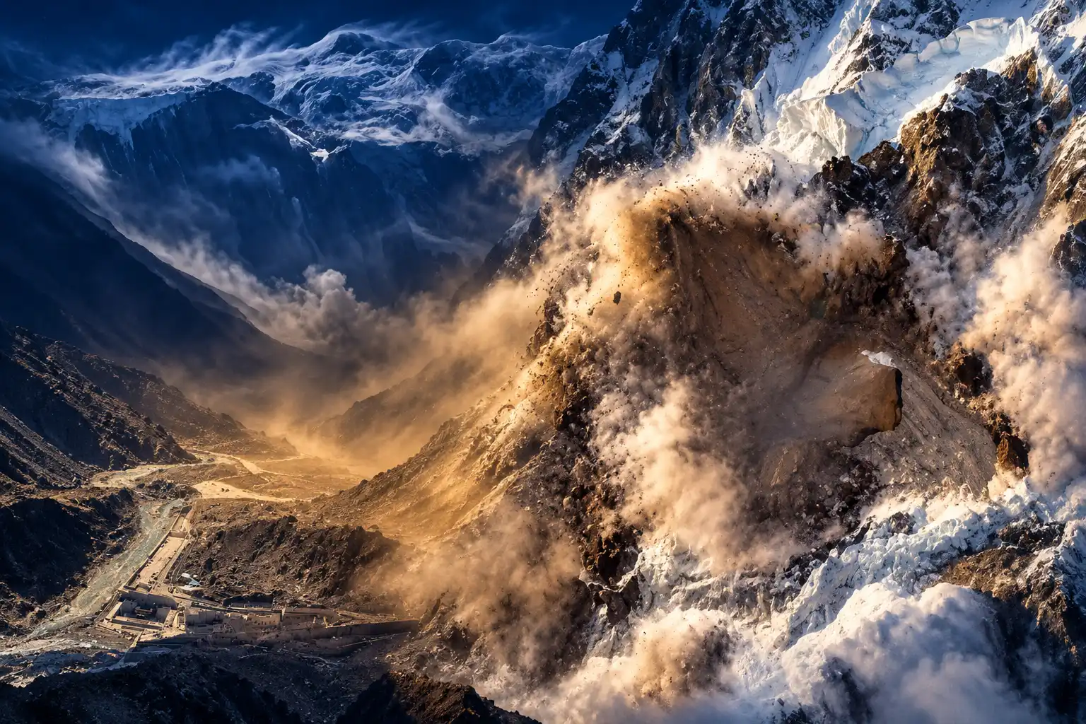
An ice-and-rock slope on Langtang Lirung collapsed at 8:37 a.m. on 26 August and hit the Nepal-China border 7.5 minutes later. The United States Geological Survey classed the shock as a magnitude 5.2 landslide, not a tectonic quake. Nepal’s National Disaster Risk Reduction and Management Authority has recovered 1,355 bodies, and 4,996 people remain unaccounted for.
Radar from Europe’s Sentinel-1 satellites had already recorded that slope accelerating. The public text alert went out 38 minutes after the fall.
The Slope Was Already Speeding Up
Langtang Lirung, the 7,234-metre high point of the Langtang Himal, sheds ice and rock on a north face that drains toward China before the water turns back into Nepal. Manoochehr Shirzaei, a geophysicist at Virginia Tech, analysed radar collected by the European Space Agency’s Sentinel-1 satellites between 8 January and 18 August. The last pass came seven days before the collapse.
Near the failure zone the glacier-rock system was creeping downhill at roughly 10 millimetres per month. Ordinary glaciers can move 10 to 200 metres a year, so a steady crawl at that millimetre rate would not, on its own, have emptied a valley. The change in speed did the talking. Shirzaei said the rock and ice near the likely break were accelerating in the days before the slope gave way, which is the signal that deformation is no longer in a groove.
The acceleration is more important than the velocity, because it suggests that the rate of slope deformation was changing in the days leading up to the disaster.
Manoochehr Shirzaei, geophysicist, Virginia Tech
He was careful about what that radar could not do. The acceleration, he said, would not have spelled out “collapse imminent, evacuate now.” It could have marked the north face as a hotspot that needed closer watch. Sentinel-1 radar ice monitoring already tracks ice flow through cloud and darkness; what is missing is a Himalayan loop that turns those millimetre shifts into a siren on the river below.
Kristen Cook, a geomorphologist at Université Grenoble Alpes, later read clearer images as a bedrock failure that took the glacier with it. The ice sat on the slope. The rock under it went first. Lake sensors were never going to see that.
Seven and a Half Minutes to the Border Gate
Austin Lord, a senior fellow at the Stimson Center, reconstructed the chain as a cascade, not a rain flood. A mass of bedrock and glacial ice of almost 100 million cubic metres came off the mountainside at about 5,200 metres, ran more than 2,000 metres down a steep face, and slammed into the Lhende River on the China side of the border. The flow then turned west and southwest, pushing the river ahead of it at an average of about 160 kilometres an hour. It was a clear monsoon morning. No extreme rain was recorded at the source.
THE MORNING OF 26 AUGUST
- 8:37 a.m.: Ice and rock detach on the north side of Langtang Lirung and register as a seismic shock.
- About 8:44 a.m.: The debris wave reaches Chinese border facilities at Rasuwagadhi, 7.5 minutes after the cascade began, a moment caught on CCTV.
- Minutes after: The surge crosses into Nepal, erases Timure, and wrecks the 111 MW Rasuwagadhi hydropower plant and the Timure dry port.
- Downstream through the morning: The wave runs the Bhote Koshi and Trishuli, taking Syaphrubesi, Mailung, Betrawati and Trishuli Bazaar, and is still a one-metre pulse at the Nepal-India border.
Lord’s team now treats any brief dam on the Lhende as limited. The flow was largely continuous. Nineteen bridges and roughly 40 kilometres of highway went with it. International Water Management Institute hydrologists timed the same border hit at about seven minutes and put the speed near 170 kilometres an hour; the Stimson clock of 7.5 minutes at 160 kilometres an hour matches the 20 kilometres from the source to the gate. At Galchhi, the International Centre for Integrated Mountain Development said the Trishuli rose as much as 9 metres in 30 minutes. That is not a river people outrun on foot. It is a wall.
USGS Rewrote the Shock as a Landslide
Seismic stations first offered a magnitude 4.4 earthquake about 55 kilometres northwest of Kodari, at 28.271 degrees north, 85.515 degrees east, with an origin time of 02:52:10 UTC. Nepali officials spoke of a quake that might have shaken a glacier loose. The geology ran the other way. After waveforms, long-period waves and satellite images were re-read, the agency replaced the quake with a landslide and raised the size to 5.2.
Additional analysis of nearby seismic stations, long period seismic waves, and satellite imagery led to the determination that the seismic event was instead a glacial collapse and debris flow, and that no earthquake had occurred.
U.S. Geological Survey, magnitude 5.2 landslide record, 26 August 2026
The magnitude 5.2 landslide record sits at 0.0 kilometres depth, which is what a slope failure looks like when it is not a fault breaking in the crust. Ramit Debnath of the University of Cambridge wrote on 8 September that the collapse, the seismic pulse and the downstream flood were a single multi-hazard cascade. The first public story, a quake, ate the minutes that a debris-flow siren would have needed.
Why Did Nepal’s Flood Alert Arrive Late?
Nepal’s Department of Hydrology and Meteorology learned of the flood about 23 minutes after 8:37 a.m. Text alerts telling people in Rasuwa, Nuwakot, Dhading and Chitwan to move to higher ground went out at 9:15 a.m., 38 minutes after the ice-rock avalanche. By then the gate at Rasuwagadhi had already been buried. Dharam Raj Uprety, chief executive of the disaster authority, said people did not even get five minutes of lead time. Shushil Kumar Shrestha, a senior divisional engineer at the same agency, said the flood rose so fast that residents could not reach safety even though the river system was working.
WHAT WAS WATCHING, AND WHAT WAS NOT
- Khumbu sirens: Nepal already runs water-level sensors, weather stations and automatic sirens for glacial-lake hazards in the Khumbu region, a design built around lakes that fill and then burst.
- Cirenmaco lake loop: Researchers at Cirenmaco in Tibet watch lake level, ice and rock collapses and downstream runoff in real time, with the aim of catching precursors before water hits villages.
- River gauges on the Bhote Koshi: Automated stations at Bhote Koshi and Syabrubesi were meant to trip on a rising flood, not on a hanging slope failing two kilometres above the channel.
- The missing satellite loop: Shirzaei said the region still lacks a system that hunts accelerating glacier and rock-slope deformation and feeds it straight into flood and avalanche models for people downstream.
Anil Pokhrel, a former chief executive of the disaster authority, put it more sharply: sensors alone are not a system. A system needs a map of who is in the path, a watch that sees the hazard in time, a way to shout, and a plan for the shout. Lord’s cascading-disaster warning work in Nepal has been arguing the same point since 2022. The north face that failed sits in a thin strip of Nepali land that drains north into China, between the science long aimed at Langtang’s south side and the Chinese watch that tightened after a smaller flood last year. Of roughly a dozen extreme flows in the region in ten years, Lord noted, only the 2023 South Lhonak outburst in Sikkim began at a site already on a hazard list.
The Same River Flooded in July 2025
On 8 July 2025 a large lake on the Purepu Glacier drained into the same Lhende channel, killed 19 people, wrecked the Friendship Bridge at Rasuwagadhi, and damaged hydropower plants that would be hit again 13 months later. That event was a lake emptying, the hazard Himalayan gauges are built to see. After it, Kathmandu and Beijing said they would share real-time information on floods, landslides and glacial lakes. More than a year on, no signed pact was in force on 26 August.
On 27 May 2026, three months before the ice-rock fall, about ten Nepali officials and a dozen Chinese counterparts, including from Tibet, met in Kathmandu to talk about glacier and flood monitoring. Binod Parajuli, a government hydrologist, said the Chinese side did not have a mandate to sign what Nepal wanted and asked for more talks. The Chinese embassy in Kathmandu later said the May meeting had made substantial progress on sharing disaster information and that Beijing had passed on important information in a timely way. Hydrologists on the Nepal side still describe a corridor with no automatic feed from upstream sensors into Nepali sirens.
Two lakes formed in the wreckage of the August collapse. The U.S. Embassy in Nepal said on 30 August that one was draining and a second, larger lake was still being assessed, and told travelers to stay off the road north of Dhunche until both had gone down.
Continued Flood and Landslide Risk and Travel Disruptions
Location: Northern Rasuwa District and communities along the Bhote Koshi and Trishuli river corridors
Event: Search, rescue, and recovery operations continue following the severe August 26 flood in northern Rasuwa… pic.twitter.com/QuhisM2U7M
— U.S. Embassy Nepal (@USEmbassyNepal) August 30, 2026
The July flood and the August cascade were different machines on the same track. One was a lake. One was a mountain face. The unsigned sharing deal was written for the first. The second arrived on a blue-sky morning and used the same villages as a chute.
Most Recovered Bodies Were Found in Chitwan
As of 8 September the disaster authority listed 1,355 recovered dead in Nepal and 4,996 missing, including 589 foreign nationals. Search teams had pulled 13,396 people to safety. More than 21,000 security personnel were still deployed, among them 9,287 from the army, 7,912 from the police and 4,203 from the Armed Police Force. Preliminary losses to property, housing and infrastructure stand at Rs387.5 billion ($2.56 billion). Chinese media reports as of 7 September put the Tibet toll at 43 dead, with more than 500 missing in Gyirong County. On 1 September the authority said 1.6 million people had been affected. Around 50,000 people live in Rasuwa district, many of them Tamang, with more drawn in by the border trade and by the road to Mount Kailash.
BODIES RECOVERED BY DISTRICT
| District | Bodies recovered |
|---|---|
| Chitwan | 363 |
| Nawalparasi East | 222 |
| Nawalparasi West | 221 |
| Nuwakot | 197 |
| Rasuwa | 169 |
| Gorkha | 75 |
| Dhading | 70 |
| Tanahu | 38 |
The origin districts still hold most of the missing, 2,340 in Nuwakot and 1,967 in Rasuwa. The largest counts of recovered bodies are far downriver, in Chitwan and the two Nawalparasi districts, because the surge carried people onto the plains. As of 7 September only 98 bodies had been identified and handed to families. Police said remains found after a long ride in water and mud were often damaged, decomposed or incomplete, so DNA work has started.
Hydropower sat in the same chute. The Ministry of Energy, Water Resources and Irrigation said nine running plants with 359 megawatts, and five plants under construction with about 395 megawatts, were badly hit, close to 10 percent of national output. Hundreds of project workers were among the missing. On about 5 September rescuers broke through to Kabir Maharjan and Sanjay Sah, who had survived nine days in a cable-duct tunnel about 160 metres from an exit, with no food and only muddy water, after the flood sealed the works.
Compound Cascades Outrun the Text Alerts
Shirzaei said high-mountain glacier-rock failures are hard to forecast because they are not the things existing nets are built to catch, extreme rain or a named lake creeping up a gauge. The ground is remote, thin on instruments, and split by a border that makes a warning only as fast as two capitals agree to share a reading. Nepal has lake sirens in Khumbu. Tibet has a live loop at Cirenmaco. The Langtang north face had millimetre radar and no plug into the phones in Timure.
The International Water Management Institute pointed to the cryosphere report on slope thaw for the longer physical setup: glacier retreat and permafrost thaw cut the strength of mountain faces, meltwater works into ice and cracked rock, and freeze-thaw keeps prying. How much of that mix, plus the 2015 Gorkha earthquake’s memory in the same massif, primed this particular cliff is still under study. Chamoli in 2021, Melamchi the same year, South Lhonak in 2023 and Blatten in 2025 already showed how rock, ice, debris and a narrow river can chain. Rasuwa added a fake quake, a 7.5-minute run to a border gate, and a text that arrived at 9:15 a.m.
Debnath’s 8 September letter asked scientists and governments to treat compound climate risk as the unit of planning, not a single glacier or a single flood. The Sentinel-1 archive for 18 August is still on disk. The slope it described is gone, and 4,996 people have not been accounted for.

Xbox Sells Cloud Playtime Packs Ahead of November Caps

Xbox Puts a $1,800 Helix Behind a 2027 Handheld

Brussels Asks If Bio-Based Plastic Can Replace Recycled Content

EU Organic Deal Gates the Leaf and Doubles Exemptions

Barilla Strike Exposes Who Gains the Italian Plants

Boston Scientific Cyberattack Leaves Hospitals Waiting on Implants

Guizhou Cave Cafes Spread When Each Cavern Fills

The Second Ned Stark Kit Lands When a Banner Dies

OpenAI’s Jalapeño Chip Turns Watts Into Faster Agent Steps

Satellites Saw Nepal’s Ice Slope Move Before the Flood
-
 NEWS2 months ago
Boston Scientific Cyberattack Leaves Hospitals Waiting on Implants
-
 NEWS2 months ago
Guizhou Cave Cafes Spread When Each Cavern Fills
-
 GAMING2 months ago
The Second Ned Stark Kit Lands When a Banner Dies
-
 NEWS2 months ago
OpenAI’s Jalapeño Chip Turns Watts Into Faster Agent Steps
-

 NEWS2 months ago
MLB Quiet Periods Copy a Freeze Other Leagues Use
-

 NEWS2 months ago
Roman Space Telescope Launches After a Decade-Long Budget Bet
-

 BUSINESS2 weeks ago
Saks Kept 15 Stores While Rivals Took the Shoppers
-

 NEWS2 months ago
The Williams Sisters Get One More Night in New York